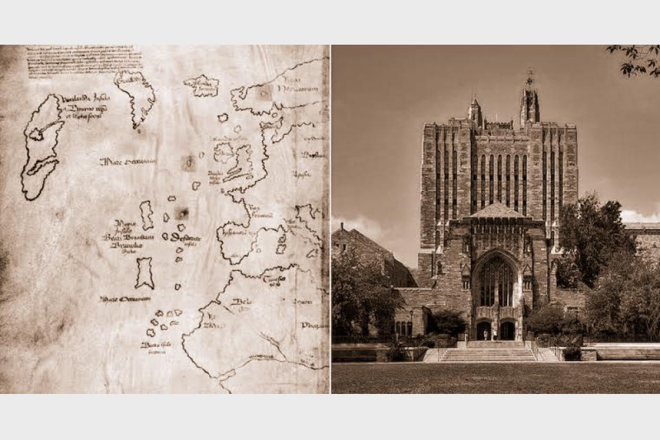
The Vinland Map has mesmerized historians for over half a century. It was thought to be one of the oldest maps of America and the first European depiction of Viking travels to the New World. It accurately depicted Greenland and was dated to 1440 A.D., 52 years before Christopher Columbus arrived on America’s shores.
Historians have no doubt that a small group of Vikings reached Newfoundland as early as 1000 A.D. The remains of a Norse settlement called L’Anse aux Meadows proved as much, with 13th-century written sagas chronicling their voyages. Since 1965, the Vinland Map appeared to be an authentic testament to those events.
According to a 2021 statement from Yale University, however, a new university study has found the map to be a forgery. As one of the institution’s prized possessions, the Vinland Map had been put on display and heralded as a landmark find for decades. But now, after decades of doubts about its authenticity, researchers have conclusively discovered that the ink it was written with couldn’t have been made before the 1920s.
The Tangled History Of The Vinland Map
The earliest historical traces of the Vinland Map date back to 1957. It was three years before researchers discovered the Norse site of L’Anse aux Meadows, when an antiquarian from New Haven, Connecticut, named Lawrence Witten said he purchased the map from an unidentified source in Europe.
Yale’s Vinland Map on display in 2018.
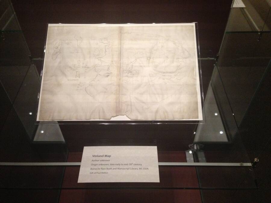
The Vinland Map was bound in a medieval book called the Hystoria Tartarorum (or Tartar Relation), which has since become an invaluable artifact in its own right. For Witten, the map was merely an investment. He tried selling it to the British Museum, who rejected his offer, and then sold it to a man named Paul Mellon.
As a well-intentioned philanthropist, Mellon donated the Vinland Map to Yale University which unveiled the parchment in 1965. It was then that the school’s researchers dated the map to 1440, published a book on their newfound treasure, and saw newspapers chronicle the colossal ramifications of its authenticity.
The Vinland Map had thrown a proverbial monkey wrench into countless fields of academia. It had accurate depictions of North America’s coastline southwest of Greenland, and bolstered the nascent notion that Vikings had used maps to arrive in regions like Newfoundland — and did so far earlier than Columbus.
It didn’t take long for the tides to turn, however. According to NPR, researchers from McCrone Associates deemed the map a forgery in 1973. While Yale University appeared to backtrack in its confidence a mere year later, the school plainly stated that the Vinland Map “may be a forgery” but didn’t commit — until now.


